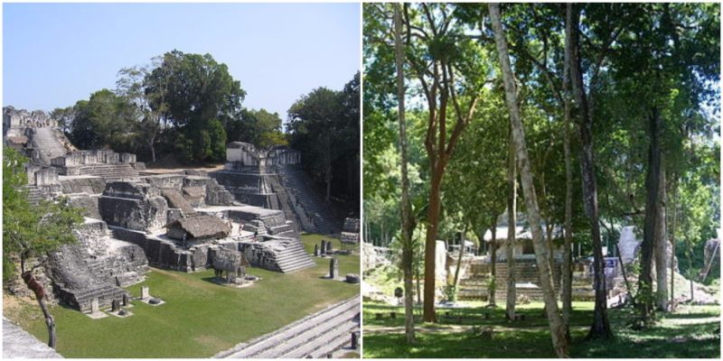
Tikal is an archaeological site located in the middle of the jungle in northern Guatemala. It is the massive remains of a ruined ancient city of the prosperous Mayan civilization. The Mayan people called their enormous settlement Yax Mutal and lived there between the 6th century BC and the 10th century AD.
Throughout the centuries, the area, which is surrounded by rich vegetation, grew into a ceremonial, military, cultural, and commercial center and was a capital of the most powerful kingdom of the ancient Mayans.
At its peak, the place became one of the greatest cities in the Mayan world and in all of Mesoamerica, with a population of perhaps over 100,000 inhabitants.
At first, like many Mayan settlements, this location developed from a small village when the first settlers arrived there in the 9th century BC. There are numerous unique pieces of artistic and architectural artifacts of the Mayan civilization from the Preclassic Period (6th century BC).
In the Early Classic Period (1st century AD- 6th century AD) the region of Tikal was a significant spot on the trading route that was established throughout Mesoamerica. The region was connected with neighboring areas, but also with the important metropolis of Teotihuacan in Mexico. Teotihuacan even conquered the area of Tikal in the 4th century AD. In the 6th century, the power of Teotihuacan declined, and after short wars with the local rival kingdoms (Uaxactun, Yaxha, Calakmul and Caracol), Tikal continued to thrive and increased its influence over large part of southern Mesoamerica in the Late Classic Period.
Between 6th century AD and 8th century AD, it reached its artistic and architectural climax and saw the construction of great pyramids, temples, plazas, and palaces. For unknown reasons, like other Maya cities and complexes, Tikal fell into decline at the end of the 9th century and was effectively abandoned.
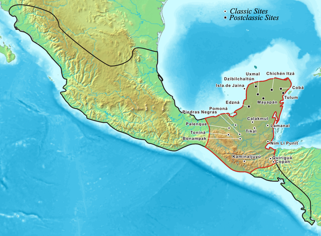
The causes of the Mayan empire’s breakdown may appear to be a mystery, but the constant stress caused by wars, overpopulation, scarcity of food, and resource depletion led to the area being deserted and depopulated.
Small groups continued to live at the site for almost a century, but the area was completely abandoned in the 10th century. The great stone monuments were slowly reclaimed by the jungle. Even Hernan Cortes and the conquistadors, while they were marching in the region in 1525 and conquering the New World, didn’t notice the configuration of the large city and its 145 feet tall structures hidden between the gigantic cedar and mahogany trees of the jungle. The site was rediscovered in the middle of the 19th century and archaeologist and treasure hunters began exploring the ruins.
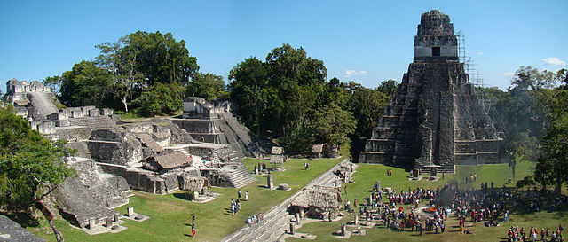
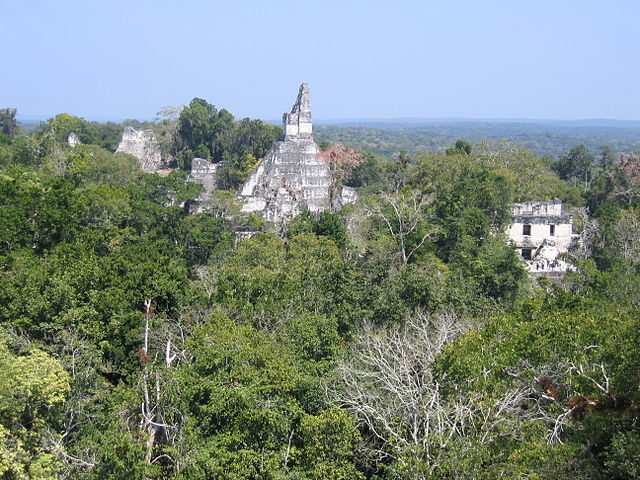
There were several projects working to preserve the site. During the restoration, it was concluded that Tical was one of the largest ancient cities in the Americas. There are over 3,000 structures and the discovered remains of the city are spread over 6 square miles.
There may have been 48 square miles covered with structures, but the area has to be cleared, explored, and mapped in the future to confirm this. Smaller structures that probably served as houses are located at the periphery of the site. The main structures are in the center of the city and cover 1 square mile. The architecture of the ancient city is constructed mainly from limestone. The main structures of the site are five pyramidal temples and three large complexes, known as the Acropolis. These probably were temples and palaces for the rich members of the society. The complexes are composed of many buildings.
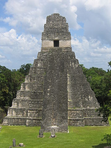
There are a number of smaller pyramids and palaces, platforms, and administrative buildings. Under some of the buildings were found richly arranged tombs. In 1958, the tomb of Ah Cacau (Lord Chocolate), one of the Tikal’s greatest rulers, was found inside Temple I. His skeleton was surrounded by precious jade ornaments, pearls, pottery, and alabaster.
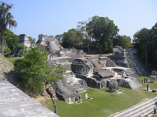
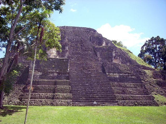
Many carved stone monuments, known as stelae, each one paired with a disc-shaped altar, stand in lines throughout the plazas and along surrounding platforms. Carvings and glyphs honor important dates and the life of Tikal’s rulers. The limestone used for the structures was local.
The craters formed by extraction of stone were used as reservoirs. The main plazas were covered with stucco that was arranged on levels, so that rainwater was channeled into canals that fed into the reservoirs. A network of causeways connected different parts of the city.
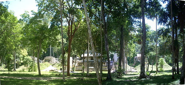
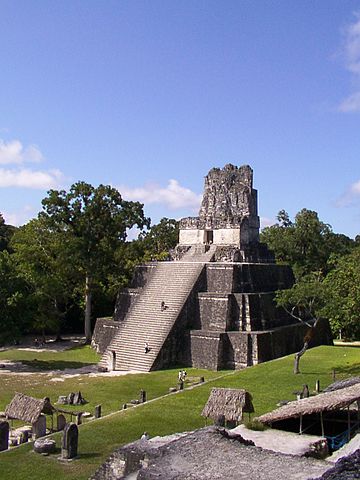
But main attraction on the site are the pyramidal structures. On the top of Pyramid I is the Temple of the Jaguar, which stands at 148 feet high. Pyramid II is 138 feet high and is connected with the Temple of the Masks. Pyramid III is 180 feet high. Near the Plaza of the Seven Temples is the Pyramid V, which is 187 feet high.
The highest of the monuments is Pyramid IV (213 feet high), which also is the site of the Temple of the Two-Headed Serpents. Pyramid IV is the highest pre-Columbian structure in Americas. From the top of the pyramids, Mayan astronomers tracked the movements of the stars and planets.
The site, situated in the archaeological region of the Paten Basin, is part of Tikal National Park and was declared a UNESCO World Heritage Site in 1979. It is one of the most visited locations on the Yucatan Peninsula.
